Looking for the best easy hikes in Sedona? This is the guide for you!
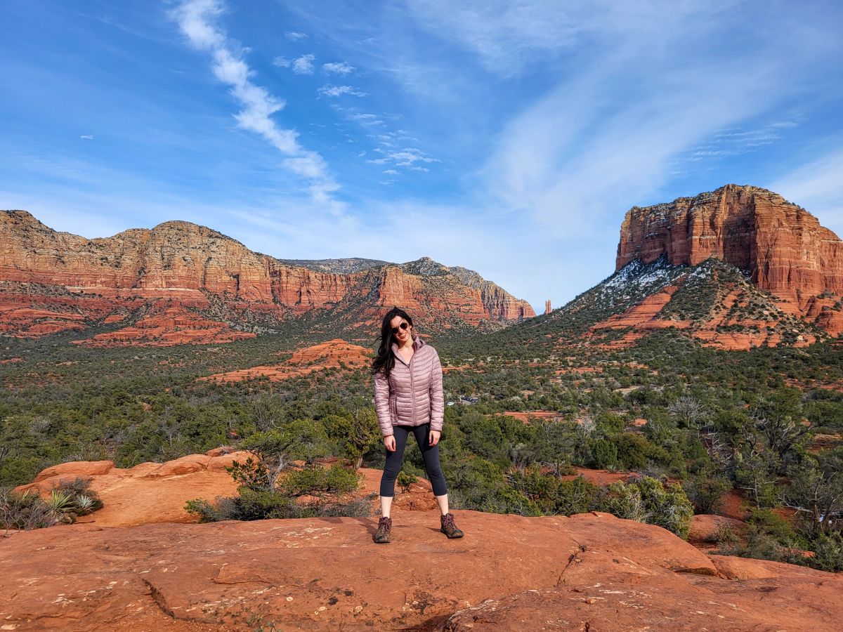
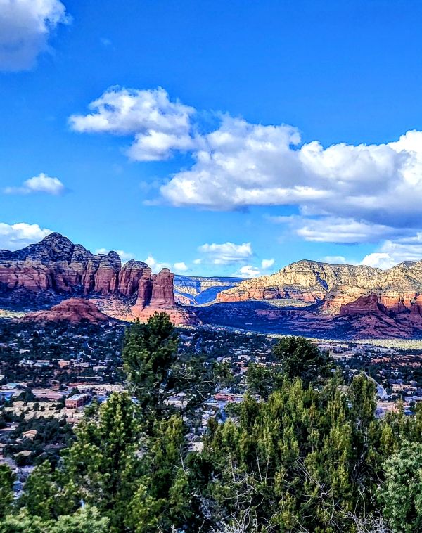
Sedona is perhaps one of the most breathtaking places in the United States. Its famous red rock formations are known around the world.
Located in Northern Arizona, Sedona is particularly known for its outdoor adventure activities.
I have visited Sedona at least 5 times and continue planning my return trips.
Sedona has incredible hiking trails through the Coconino National Forest that are conducive to a variety of hiking levels.
Exploring some of the most beautiful views on an easy hike in Sedona is very doable.
One of the best things about Sedona is being surrounded by incredible views no matter where you are. No need to scale a 10-mile summit to experience all of Sedona’s beauty!
Sedona is enjoyable by foot on a variety of easy hikes. This round-up guide features the best easy hikes in Sedona from the first-hand perspective of many travel bloggers.
Let’s explore the beauty of red rock country with the best easy hikes in Sedona!
10 Best Easy Hikes in Sedona
1. Yavapai Vista
Length: .5 miles
Difficulty: Easy
Yavapai Vista is a famous engagement and wedding elopement location in Sedona. With its easy approach and breathtaking views, it’s no wonder why!
But you don’t need an elopement to explore the incredible hike!
One of my favorite things about Yavapai Vista is its near 360° panorama views.
It is a 15-minute flat out and back trail. The distance and flat terrain make it a good option for hikers at a variety of levels.
I recommend combining Yavapai Vista during my Sedona girls weekend itinerary.
Bonus: The parking lot was open during my visit on a very crowded weekend.
⭐Popular Sedona Tours
2. Sugarloaf Loop
Length: 2 miles
Difficulty: Easy
Sugarloaf Loop trail is a gem located away from the most crowded areas of Sedona.
You can also spot rock climbers along the route! Dogs are allowed on this trail.
Sugarloaf Loop boasts 360 panoramic views from a mostly flat route. There is uphill walking when approaching the summit, but you can skip this if you want to hike on flat terrain only.
My first couple of times on the trail were cutting through to access rock climbing routes, but I quickly learned how beautiful the entire Sugarloaf area of the Coconino National Forest is for hiking.
The parking lot is small so I recommend arriving early in the morning or later in the afternoon during the high season.
During the low season in the winter, you should find a parking space at any time. No parking pass is required to park in this lot.
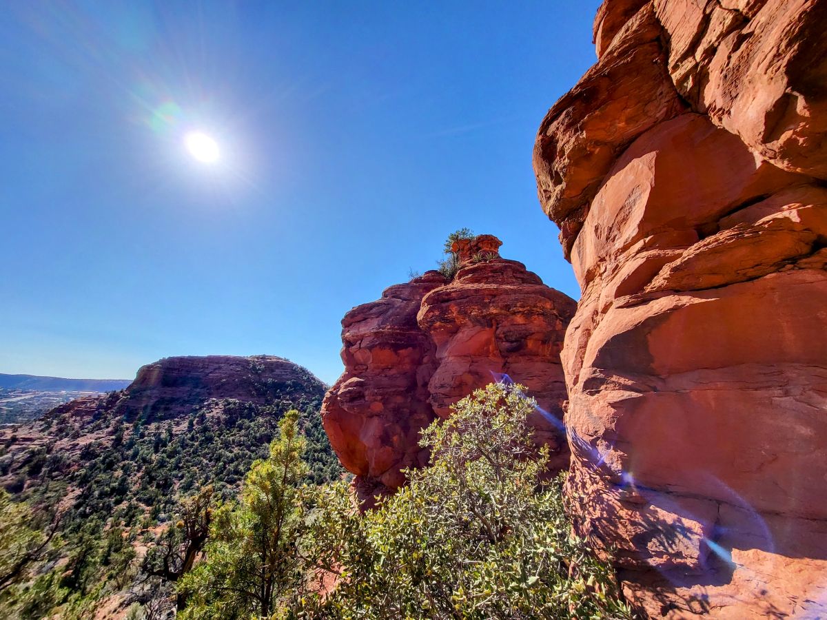
3. Teacup Trail to Coffeepot Rock
Length: 2.7 miles
Difficulty: Easy
Coffeepot Rock is a quintessential hike in Sedona. And taking the Teacup Trail will take you to the base of this large rock shaped just like a coffee pot!
The Teacup trailhead shares a parking lot with the Sugarloaf trail, so get here early to secure a parking spot.
Embark on the hike as you marvel at red rocks and cacti all around you. You’ll go deeper into the red canyon walls until a little after 1 mile in you’ll see Coffeepot Rock up close and personal.
This is a great ‘bang for your buck’ hike in Sedona since it is not terribly long or difficult, and you still get fantastic views. Give yourself 1-2 hours to complete the hike.
Although the trail is considered easy, it is recommended to download the Alltrails map and look at it often since many trails intersect it.
This hike is one of the best easy hiking trails in Sedona, which also makes a great stop on a road trip from Las Vegas to Monument Valley!
4. Seven Sacred Pools
Length: 1.1 Miles
Difficulty: Easy
The Seven Sacred Pools trail is a series of seven small pools or potholes.
A nearby seasonal stream feeds the red sandstone pools. Local Native Americans consider these pools sacred, hence the name.
When heading to the sacred pools, you will take Soldiers Pass Trail No. 66. Along the way, you’ll pass by Devil’s Kitchen sinkhole, one of Sedona’s largest natural sinkholes.
You’ll even encounter impressive cliffs and natural rock formations! I finished the out-and-back trail in less than 30 minutes.
If you would like to extend the hike, continue along the path to explore the rest of the Soldiers Pass Trail.
The trailhead parking is limited. The gate opens at 8am and closes at 6pm.
The City of Sedona offers a free shuttle service that whisks you from a central park & ride location right to the trailhead. It operates Thursday through Sunday during the high season.
As experienced by Teresa of An Acre in the City.
⭐Popular Sedona Hotels
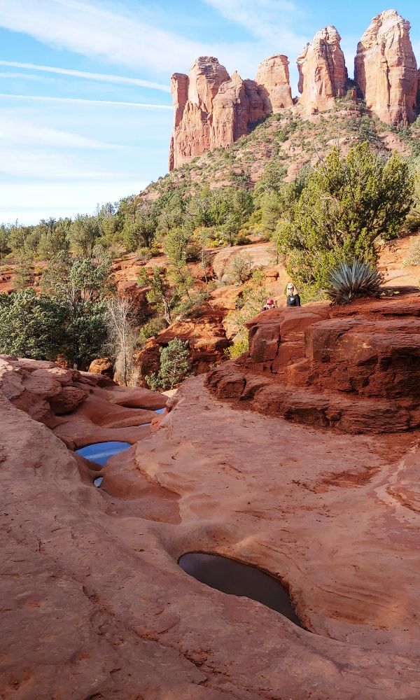
5. Secret Slick Rock
Length: .74 Miles
Difficulty: Easy
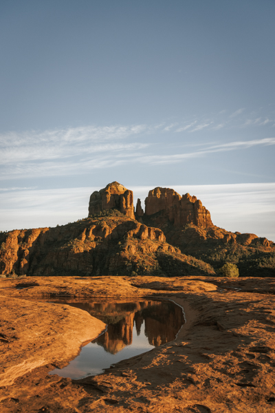
The Secret Slick Rock trail is great at any time of the day, but in my opinion, the best time to visit is at sunset. In fact, Secret Slick Rock is one of my all-time favorite sunsets in Sedona.
The trail begins flat, leading you through beautiful desert plants before a slight decline in elevation and an open expansive view of Cathedral Rock from a massive slick rock slab.
If you get the chance to visit after a good rain, the place is even more magical. Divots in the slick rock create pools of water. And those pools… they create the best reflection of Cathedral Rock.
I recommend planning to spend 30 minutes to an hour here. The hike itself only takes about 10 minutes, but plan to spend more time soaking in the views!
As experienced by Heather of Arbours Abroad
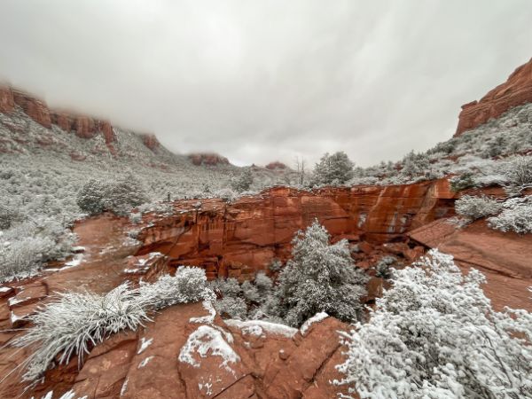
6. Devil’s Kitchen
Length: .4 miles
Difficulty: Easy
Devil’s Kitchen in the Coconino National Forest near Sedona, Arizona, is a natural wonder. The vibrant red rock formations along the trail are incredible! And the snow-dusted mountain tops during winter in Sedona add to its beauty.
The hike to Devil’s Kitchen is an easy .4-mile out-and-back hike on the Soldiers Pass trail that generally takes about 20 minutes roundtrip.
The mostly flat dirt trail provides beautiful red rock views as soon as you begin hiking.
The hikes in and around Sedona are some of the most scenic in the world and are on par with those in Yosemite National Park.
If you are looking for a longer hike, continue on the Soldiers Pass trail to the Seven Sacred Pools or the caves.
The Devil’s Kitchen is a sinkhole created in 1888 when a cave suddenly collapsed. About a hundred years later, in 1989, another large portion of the rock area collapsed creating an even larger sinkhole.
The parking lot at the Soldiers Pass trailhead is small and provides limited accessibility to the trailhead during high season.
Sedona offers a shuttle bus to the Soldiers Pass trailhead when the parking lot is closed.
As experienced by Michelle of The Trav Nav
7. Airport View Trail
Length: 1.4 miles
Difficulty: Moderate
The official Airport View Trail is rated as moderate, but the views can be enjoyed with no hike at all. Park at the Airport parking lot and simply walk to the viewpoint.
Parking costs $3 or is free with the Red Rocks pass or the annual America the Great National Parks pass. There are binoculars available here for one quarter to use.
Airport View Trail begins at the top of the mountain, so the best views are arguably from the starting point.
This trail is officially rated as moderate due to the rocky terrain walking downhill. It is an out-and-back trail so it requires walking back up the rocky terrain to get back to the starting point.
Visitors can alternatively hike Airport Loop Trail for a more challenging route.
Whether you complete the entire hike or just enjoy the views, I highly recommend visiting.
In my opinion, the Airport View provides some of the best views in all of Sedona.
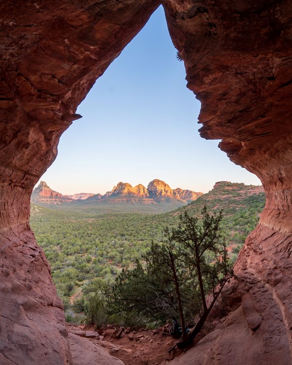
8. Birthing Cave Trail
Length: 1.9 miles
Difficulty: Moderate
The Birthing Cave in Sedona is one of the most bang-for-your-buck trails in town!
It has an iconic diamond-shaped opening that overlooks the red rock mesas and cliffs in the distance.
There’s a handful of free parking spots along the eastern and western sides of Long Canyon Road by the trailhead.
Unlike a lot of hikes in Sedona, the Birthing Cave seems to have largely flown under the tourist radar, and there’s usually no trouble finding parking.
However, if you’re visiting during peak season (March – June or September – October), consider arriving bright and early to make sure you snag a spot.
While the hike itself is relatively easy, following the correct path can be tricky! The trail is not well-marked and seemingly has endless trails that can lead you astray.
Download a map of the trail ahead of time so you can stay on the trail.
If you really want a bucket list experience at Birthing Cave, arrive at sunset.
Sit on the sloping walls of the cave for an excellent vantage point of the sun setting over Sedona’s famed red rocks!
As experienced by Jessica of Uprooted Traveler
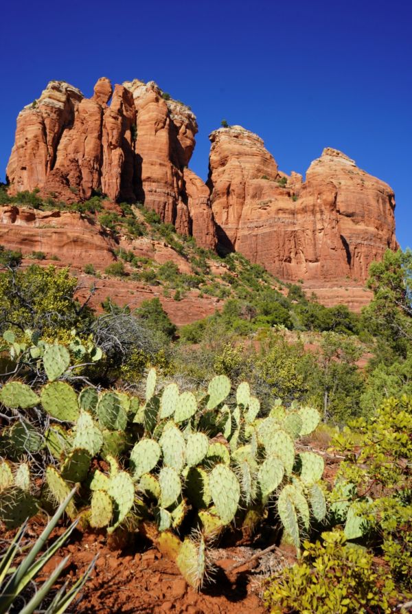
9. Bell Rock
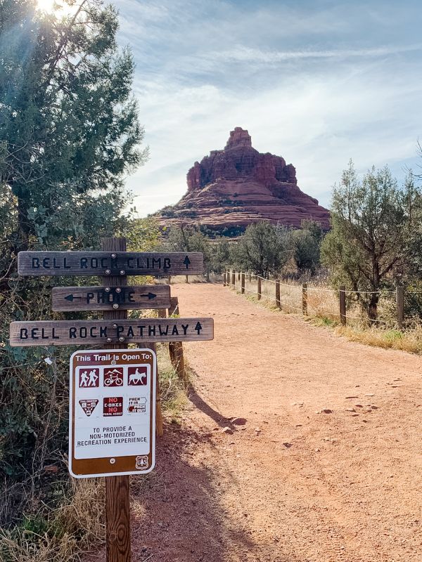
Length: 1 mile
Difficulty: Moderate
The scenery on Bell Rock Trail is beautiful and makes for a very serene hiking experience, especially in the spring and fall. The trail is pet-friendly but not wheelchair accessible.
There are three different parking areas for Bell Rock. Bell Rock Trailhead North is the closest lot to the trailhead and is always very busy.
Yavapai Point offers overflow parking for the Trailhead North lot. Bell Rock Trailhead South is the farthest lot from Bell Rock.
The hike is relatively straightforward until you reach Bell Rock. There isn’t a distinct trail to follow, requiring rock scrambling to climb higher.
Alternatively, consider Bell Rock Pathway for a smoother and more accessible experience if needed. Bell Rock Pathways is rated as Easy on AllTrails.
The Red Rock Pass or America the Beautiful Pass is required to visit Bell Rock.
As experienced by Candice of CS Ginger
Conclusion
Sedona is one of the most beautiful red rock locations in the United States. Thanks to its many easy hiking trail options, everyone can enjoy a bit of the nature Sedona has to offer.
It makes an amazing weekend trip from Phoenix, providing new adventures and iconic views.
There are also plenty of things to do in Sedona besides hiking. Combining activities will help you diversify your trip and ensures there is something for everyone to explore.
No matter which trails and activities you choose, I hope you have an amazing time on your Sedona trip!